Thursday, April 28, 2011

Langun-Gobingob Caves


Langun-Gobingob Caves in Calbiga, Samar is the biggest cave in Southeast Asia. It is a 12 cave system that will take 3 days and nights to explore. Also known as Calbiga Caves in Samar, it is the 2nd largest cathedral cave in the world. Most of Calbiga Caves, covering a 2,968 hectares area is still unexplored.
The main cave is called Langun and is visited on spelunking trips. The main chamber is so huge that it can accommodate 50 commercial planes put together side by side or equivalent to three football fields. The caves are famous for speleothems and a wide variety of cave life. There are numerous endangered species of bats living in the cave. True troglobionts are cave crickets and eyeless fish.

Sunday, April 24, 2011

Manila Cathedral


On January 24, 1571 , feast of St. John the Baptist, the Spanish conquistador Miguel Lopez de Legaspi founded the city of Manila . He earlier took possession of Maynilad, the native settlement of Rajah Matanda and Rajah Sulayman on May 19, 1571 and firmly established Spanish authority in the newly conquered and untrammeled turf. The historic day happened to be the feast of Santa Potenciana and to honor her, she was made patroness of the new territory. Armed with the Spanish sword and the Cross, Legaspi, in his role as conquistador, apportioned a parcel of land for the church of the new settlement under the patronage of La Purisima Inmaculada Concepcion.
The Church of Manila was established by the secular Juan de Vivero who had the honor of baptizing Rajah Matanda. Vivero first arrived in these shores in 1566 as chaplain of the nao or galleon of San Geronimo which had come to support the Spanish colonization of the newly discovered islands. He was given the special privilege and sole faculty by the Archbishop of Miexico to establish the spiritual administration of the new Philippine colony. Later, Vivero would become the first vicar-general and the first ecclesiastical judge of Manila .
The Church of Our Lady of the Immaculate Conception administered the religious affairs of Manila until such time it became a parish and Manila was created into a diocese. It was a simple structure of nipa and bamboo, materials which were readily available during that time. It had for its first parish priest the secular Juan de Villanueva. The other religious who became the pillars of this parish were Juan de Vivaneta and Nicolas Riccio.
This church was also witness to the events that would threaten the city and its residents. On November 30, 1574 , the feast of St. Andrew the Apostle, the Spanish forces were able to quell Limahong’s invasion. Because of such fortunate turn of events, the holy apostle was made patron saint of Manila . The victory was celebrated with fireworks and a Mass with sermon was held in the Church of Our Lady of the Immaculate Conception in Manila .
 

Monday, April 18, 2011

Tinuy-an Falls


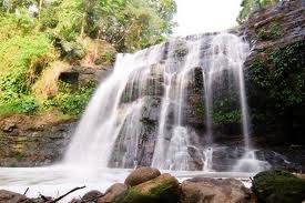
Tinuy-an Falls is a waterfall in Bislig City, Surigao Del Sur in the southern Philippine Island of Mindanao. It is the main tourist attraction in Bislig, a city known as the Booming city on the bay.
The falls is approximately 55 metres (180 ft) high, touted as the Niagara Falls of the Philippines, Tinuy-an is a white water curtain that flows in three levels. It is one of the best waterfalls in the entire Philippines because of its majestic and unique natural formation. Its colorful picture was once appeared in the International Travel Magazine.
Its magnificent cascades are found in Borboanan, Bislig City, a one hour ride from Mangagoy, center of trade and commerce in Bislig City. About 55 meters high and a breathtaking width of 95 meters, it is said to be the widest in the country. Centuries old amazing giant trees, ferns and vines in a thick rainforest envelop your ride through thick forested hills that enclose the falls. Islets are on the swimming ground, with slippery logs where you can cross for a good view, plus multi-layered stones as pathways. Every morning, the area is blessed with a sprinkle of a rainbow that appears between 9 a.m. to 11 a.m.

Kawasan Falls


Kawasan has three waterfalls. The first one is mainly the largest of the three, and is usually the most crowded. An uphill climb for fifteen minutes will take you to the second falls, and another, to the third. You may bring in food, or buy from the resort's restaurants. Cottages and tables are also available for rent, as well as rooms for overnight stay. You may rent a raft to take you around the "pool" or for a refreshing "shower massage" under the falling water. Life vests are also available for a very affordable price.

The pathway may be very dark once the sun sets so its best to have a flashlight at hand. One should be extra careful in going down the slope especially those descending from the second or third falls to avoid mishaps or accidents.


Kawasan Falls is a popular get-away destination in the southern part of Cebu to locals and foreigners alike. With its lush tropical trees and plants everywhere, peaceful flow of the river as it gracefully rushes to the distant sea, the sound of the waterfalls on the background, friends and loved ones enjoying the cool and deep fresh water, everything around just seems so relaxed, simple and very serene.

Sunday, April 17, 2011

Apo Reef Natural Park


Apo Reef Natural Park is located in Sablayan, Occidental Mindoro. "It is acclaimed as the best in Asia and second largest in the world, as the diving mecca of the Philippines. It is a 34- kilometer reef, located 20 miles west of Mindoro proper, with a narrow channel running east to west, dividing this reef into two lagoon systems, north and south. Underneath, the clean waters, fine white sand and numerous corals are visible.

The Apo Reef includes the fascinating bird-populated islands of Binangaan and Caois del Bajo, which have a variety of birds that can irresistibly lure birdwatchers. The surrounding waters are abundant with marine fauna and luxuriant coral growth represented by approximately 400-500 kaleidoscopic coral species. Marine life includes varieties of sharks, sting rays and manta rays.

Tuesday, April 12, 2011

The Monfort Bat Cave


The Monfort Bat Cave on Samal Island was recently determined to house the world’s largest colony of Geoffroy’s rousette fruit bats (Rousettus amplexicaudatus) with approximately 1.8 million bats. Bat Conservation International (BCI) the leading bat conservation organization based in Austin, Texas, U.S.A. came to visit the Monfort cave last June 2006 to evaluate the cave and determine its relative significance. BCI identified potential threats and provided management and research recommendations. The current colony exceeds the carrying capacity of the cave as large numbers of bats roost in risky locations, even on the ground which is very unusual and under large rocks on the cave floor making them very susceptible to predation by rats, crows, snakes, cats and dogs. Hunting by humans and disturbance of this species in other bat caves in the region has likely driven many bats to seek refuge in the protected Monfort Bat Cave.

Mount Pinatubo


Mount Pinatubo is situated in the southern part of Luzon. It is one of the biggest volcanoes in the Philippines. In 1991, the Pinatubo became in a few months one of the most known volcanoes in the world. In that year the Pinatubo eMount Pinatubo is situated in the southern part of Luzon. It is one of the biggest volcanoes in the Philippines. In 1991, the Pinatubo became in a few months one of the most known volcanoes in the world. In that year the Pinatubo erupted violently.rupted violently.

Mactan Island


Mactan Island lies across the Mactan Channel, opposite Cebu City in the southeast of Manila. It is modern and yet has retained its greenness and features lovely sandy beaches and good diving spots off the neighboring islets. Mactan has a long history with many stories, the most frequently told being about the Battle of Mactan. In 1521, when Portuguese-born explorer Ferdinand Magellan arrived onshore he was killed by Mactan Chief Lapu Lapu and his men.
Visitors can visit both the Magellan and Lapu Lapu shrines while visiting the island. Mactan is also important as home of Mactan – Cebu International Airport, the country’s second busiest airport as well as the country’s largest export processing zone. Mactan is also well known for producing guitars and other musical instruments.

Guimaras Island


Guimaras is the youngest and smallest of the six component provinces of the Western Visayas Region (Region 6). Known as the "Mango Country", Guimaras Island has 8,000 hectares of mango orchards managed by corporations and individual growers. The province's mango orchards produce the best mango variety certified as pest-free by the United States Department of Agriculture.
Declared as a full-pledged province on May 22,1992, Guimaras has also been proclaimed as the "island to watch" due to unspoiled natural beauty as for its potential.
The province is composed of five municipalities, namely: Jordan, the provincial capital; Buenavista; Nueva Valencia; and the newly created Sibunag and San Lorenzo. Guimaras occupies about 3% of the region's total land area.
The  fastest route to the province is by means of a pump boat which is about 10-15 minutes ride from Iloilo City.

Bataan and Corregidor


Corregidor comes from the Spanish word “corregir,” meaning to correct. One story states that due to the Spanish system wherein all ships entering Manila Bay were required to stop and have their documents checked and corrected, the island was called "Isla del Corregidor" (Island of the Correction). Another version claims that the island was used a penitentiary or correctional institution by the Spanish and came to be called "El Corregidor."
In early and pre-hispanic times, it was likely populated by fishermen and no doubt provided a base for pirates who could easily launch an attack against any vessel entering Manila Bay. During the Spanish era this tadpole-shaped island was a signal station where bonfires were lit to alert Manila of a home-coming galleon. Later on, Spaniards built a lighthouse on the island.
The Spaniards set up a naval dockyard on the island in 1795. This was followed by a naval hospital and a signal station which was used primarily to warn Manila of approaching enemies. In 1836 a lighthouse was built and in 1853 a stronger light was installed. This was replaced in 1897 and remained in use until the outbreak of the Pacific War, during which it was heavily damaged and rebuilt to the same specifications. During the Spanish times, the small town of San Jose emerged to become the seat of government on the island. Later under the Americans, it evolved into a small community with its paved streets lined with the houses of the Philippine Scouts who constituted the bulk of the garrison in Corregidor.
After the defeat of the Spanish forces by Admiral George Dewey in May of 1898, Spain ceded Cuba, Puerto Rico, and the Philippines to the Americans under the Treaty of Paris which was signed on December 10, 1898. In 1903 a former Spanish garrison building there was converted to a convalescent hospital. The island was designated as a U.S. Military Reservation in 1907 and the army post on Corregidor was named Fort Mills, after Brig. Gen. Samuel M. Mills, chief of artillery of the U.S. Army in 1905-1906. A regular army post was later established in 1908.
The following year army engineers of “H” company, 2nd Battalion of the U.S. Corps of Engineers began to build fortifications on the island to secure the seaward approach to Manila Bay. This was part of the planned "Harbor Defenses of Manila and Subic Bay" due to the strategic location of Corregidor. Concrete emplacements and bomb-proof shelters were constructed and trails and roads were laid out on the island. This engineer contingent left on March 15, 1912, after laying down the groundwork to make Corregidor a great military bastion. Thus began the transformation of a small fishing village into a fortress and site of one of the most heroic battles in the history of war.
The big guns of Corregidor in 1941 were used in support of Filipino and American defenders of Bataan until the island itself was invaded by Japanese Forces. The restless pounding by Japanese guns including intermittent bombings reduced its defenses and compelled its surrender. On January 22, 1945, Corregidor was once again caught in the fury of war as the Americans retook the island after a bloody battle.

Monday, April 11, 2011

Baguio Botanical Garden


The Baguio Botanical Garden is located east of Baguio's downtown area. You will find it between Teacher's Camp and the Pacdal Circle. Its main entrance is along Leonard Wood Road and just across the street from Gilberto's Hotel and Baguio Vacation Hotel. It is quite a large park and about the same size as Burnham Park.
Also known as the Igorot Village, the Botanical Garden features native huts typical of the type of Igorot dwellings found in the Cordilleras. The village is said to capture the ethnic spirit and cultural legacy of the Igorots and being tranquil and quiet, it is a nice place to just sit down and relax, take a leisurely stroll along its narrow and winding pathways and also enjoy the landscape where you will find numerous plants and trees.
Some years back Igorot dances and rituals were held in an improvised outdoor stage within the village. Local students go to the Botanical Garden for a day of retreat or just enjoy the outdoor environment. When visiting the Botanical Garden, you will usually find a group of Igorots at the main entrance who are dressed in their authentic native attire and regalia. They will be more than happy to pose with visitors for a souvenir picture ... of course, for a fee.

Siargao Island


This newly discovered island boasts of white-sand beaches and surfing waves compared to that of Hawaii. Lying 800 kilometers southeast of Manila, the tear-shaped Siargao Island is a perfect haven for the sun, sea, and surf buffs. It lies on the eastern portion of Surigao del Norte and on the southeastern tip of Mindanao. The island is a mass of tropical land with scores of reefs, points and white beaches.

Its promise as a surfing mecca in the making was discovered in 1993 by American surf photographer John Callahan who went to investigate the rumors of spectacular waves in a little known Mindanao town. He came back from his trip armed with stories about the lovely sun-drenched island and documented his find with beautiful photographs.

Siargao opened itself to the international surfing community by playing host to the Siargao Surfing Cup in the municipality of General Luna. Siargao's Cloud Nine break is said to be among the best in the world and foreign sportsmen view "the unparalleled surf of Siargao as a magnet for deep sea fishing, sailing, wind-surfing, kayaking, and sunbathing on miles of white sandy beaches that the reef-ringed island and its rich waters afford the visitor.

Magellan's Cross


Magellan's Cross, located in Magellanes Street, is Cebu's most important historical landmark and an important shrine.
 
In 1521 the Portuguese navigator, Ferdinand Magellan, erected the original large wooden cross at this location where Cebu's Rajah Humaton, his wife Juana, and 800 followers were baptised on April 14, 1521 and the first Catholic mass in Cebu (in fact, the first Catholic mass in the Philippines) was celebrated.

The original cross gradually deteriorated as over the years the faithful took little pieces of the cross as mementos. In 1845 another cross was placed at the spot. The new cross was made of tindalo wood and inside a hollow inside splinters of the original Magellan's Cross were preserved.

Today a tiled pavillion shelters the cross and a ceiling mural depicts the scene of the first mass and commemorates the conversion of the first Filipinos to Christianity.

Sumaging Cave


Sumaging Cave is probably one of the most popular caves in Sagada. Aptly nicknamed as the Big Cave , was created by water erosion. Sumaging is a cave of impressive size, which may be visited on organized spelunking tours. When you plan to visit the place, get a guide at the Sagada Municipal Building because no one is allowed to go to the cave without a guide and without registration. There are numerous fine formations like King's Curtain, Rice Granary, or Cauliflower. A huge hall is called the Dancing Hall. But there is also a crawl called the Tunnel. The tour includes some water passages, which is rather harmless as the temperature in Philippine caves is rather high.

Biak-na-Bato


Biak-na-Bato is a historic place during the Philippine Revolution. It is a huge split boulder which is the mountain hideout of the revolutionary forces during the Spanish regime and the place where the Malolos Constitution was signed by Gen. Emilio Aguinaldo and Pedro Paterno. It is where the historic Biak-na-Bato Republic was established. The park appeals to the adventurous spirit with its challenging rock formations. Hanging bridges and staircases connecting rivers and caves make for a pleasurable exploration. Among the many ecological attractions in Biak-na-Bato National Park are Bahay Paniki Cave, Aguinaldo Cave, Madlum Cave, Tanggapan Cave, and Tilandong Falls.

Callao Caves


Callao Caves located within the Peñablanca Protected Landscape.The seven-chambered Callao Caves boast of massive limestone and other rock formations, skylights, and a chapel. The conditions inside the cave cause stalactites and stalagmites, particularly in the deeper chambers. Every chamber has natural crevices, which let light get into the cave, serving as illumination for the otherwise dark areas of the place.

Maria Cristina Falls


Maria Cristina Falls in Iligan City is the second highest falls in the Phillipines. It is a waterfall of the Agus River on the Island of Mindanao and is a landmark of Iligan City. Because of the presence of more than 20 waterfalls, Iligan City is known as the City of Majestic Waterfalls.
Maria Cristina Falls is situated 9.3 kilometers away southwest of the Iligan City proper in the boundaries of Barangay Maria Cristina, Ditucalan and Buru-un. It’s a 320 feet high waterfall and the main source of power in the city’s industries which is brought under control by the Agus VI Hydroelectric plant operated by National Power Corporation. It’s not just supplying Iligan City’s power but it goes beyond other provinces generating 70% of Mindanao’s electricity. This means that during these days of El Niño, Mindanao is greatly affected with rotating brownout.

Tinago Falls


Tinago falls is a waterfall in Iligan City, Lanao del Norte in the southern Philippine island of Mindanao. It is one of the primary tourist attractions in Iligan, a city best-known as the City of Majestic Waterfalls. Tinago is a Filipino term meaning “hidden”, the falls being hidden in a deep ravine. Trekking to the falls takes about 500 descending steps called the winding staircase..

Hinulugang Taktak


Hinulugang Taktak is a waterfall in the Philippines found in the province of Rizal on Luzon island. The waterfall area has been designated as a National Park by the Department of Environment and Natural Resources and is one of the two most popular tourist spots in Antipolo City, Rizal's capital, the other being the Antipolo Cathedral. In 1990, the waterfall has also been proclaimed as a National Historical Shrine under Republic Act No. 6964.

Tudaya Falls


Mt. Apo, in Mindanao (in the southern part of the country), is the country’s highest peak. It is where you can find one of the most beautiful waterfalls in the Philippines – the Tudaya Falls. This 150-meter waterfall is the tallest waterfall in the Mt. Apo National Park. It is located in Sta Cruz municipality of Davao Del Sur; about 3 hours drive from Metropolitan Davao.

The Babuyan Islands


The Babuyan Islands is an archipelago located in the Luzon Strait and north of Luzon island in the Philippines. It is separated from Luzon by the Babuyan Channel and from the Batanes Islands up north by the Balintang Channel. Whether whale watching or discovering a great beach destination is your goal, Babuyan Group of Island offers a lot for the active traveler. Babuyan Island adventure is all about dreaming a vacation after it was over. Its gives you a never-ending discovery, almost impossible to forget. The experience maybe unforgiving but truly it was a walk to remember.

Mount APO


Mount Apo, active volcano, south central Mindanao, 20 miles (32 km) west of Davao City; it is the highest point in the Philippines, rising to 9,692 feet (2,954 metres). Part of the Cordillera Central, it is covered by a forest of tall, tropical hardwoods; two subsidiary peaks nearly match its height. Mount Apo National Park, established in 1936, has an area of 199,819 acres (80,864 hectares); it is the home of the rare Philippine Eagle and features numerous peaks and valleys, as well as Malasita Falls, Sibulao Lake, and the Kisinte Hot Springs.

Puerto Galera

Puerto Galera (or port for galleons, if translated literally) is a small town on the northeast coast of the island of Mindoro in the Philippines. Though it is a quiet little town, it is a popular summer destination in the country. People come here from all over the country and the rest of the world for its wonderful beaches and fun water activities. Others also come here for its nearby forests, waterfalls, and dive spots.
The little town has always been a trading haven even during the pre-Spanish era of its history. Evidence of this comes from artifacts from Thailand, Vietnam, and China dating way back into the 10th to 15th centuries. The Spanish took advantage of its natural harbor and used it for trade. The town soon became the government seat of the whole Mindoro Island. In December of 1927, Puerto Galera was turned into an independent municipality through a congressional act.

Camiguin Island


The island-province of Camiguin is a pear-shaped volcanic island in the northern tip of Mindanao. It is approximately 90 kilometers north of the City of Cagayan de Oro. It is bounded to the north by Bohol Sea, to the west by Macajalar Bay, to the southeast by Gingoog Bay and to the east by Butuan Bay.

Camiguin is the smallest province in Northern Mindanao, with its land area pegged at 29,187 hectares. It is composed of five towns, namely, Mambajao – the capital town, Mahinog, Guinsiliban, Sagay and Catarman. The island plays host to seven volcanoes, including the still-active Mount Hibok-Hibok. According to the National Statistics Office, Camiguin has a total population of 74,232 persons, making the province the second smallest in the Philippines in terms of population.


Among the Province's major products are coconut, cassava, banana, camote, palay, corn, fruits, coffee and vegetables. Camiguin's volcanic soil has proved to be a fertile ground for planting various crops. At present, the Provincial government is looking into an agricultural program that would increase the cultivation of fruit trees and vegetables in Camiguin. The Province is also among the best abaca fiber producers in the country. Camiguin is proud of its natural resources, which include sulfur deposits, geothermal energy, agricultural lands and fishing grounds.


The Camiguin culture is a mixture of both Boholano and Cebuano culture. It is very colorful and creative. The people are deeply religious, hospitable and friendly. Cebuano is the major dialect in the Province. However, in the towns of Sagay and Guinsiliban, where most of the indigenous tribes reside, the Kinamiguin dialect is still spoken. Kinamiguin is derived from the Manobo dialect with some mixture of Boholano.

EDSA Shrine


The EDSA Shrine, located at the crossroads of Epifanio de los Santos (EDSA) Avenue and Ortigas Avenue in Quezon City, is formally known as the Shrine of Mary, Queen of Peace (Our Lady of EDSA), It is dedicated to Our Lady who has miraculously interceded to oust the dictatorship in a peaceful and bloodless uprising that is now world renowned as the People Power Revolution of 1986. On December 15, 1989, the EDSA Shrine was established with then Rev. Fr. Socrates B. Villegas as Rector. Since then, the Church has grown with the help of volunteers who now have formally organized themselves into the EDSA Shrine Community. His Eminence Jaime Cardinal Sin described the EDSA Shrine as Holy Ground when another miracle, the second peaceful People Power took place in January 2001. With the help of the Blessed Mother and Santo Niño, the people’s prayer for a moral leadership was answered. A Holy Ground marker was inaugurated at the EDSA Shrine on February 25, 2001 during the 15th anniversary of the first EDSA People Power.

Barasoain Church


Barasoain Church is a Roman Catholic church built in 1630 in Malolos City, Bulacan. Having earned the title as the Cradle of Democracy in the East, most important religious buildings in the Philippines and the palace of General Emilio Aguinaldo, the Church is proverbial for its historical importance among Filipinos.

       Founded by Augustinian Missionaries in 1859, the church is also renowned for its architectural design and internal adornments. The original church was burned during the outbreak of the Philippine Revolution however, it was renovated. It is about 42 kilometers away from Manila.

       The church recorded some of the important events occurred in the country. While it has been a temporary residence of General Aguinaldo, three major events in Philippine History happened in this church: the convening of the First Philippine Congress (September 15, 1898), the drafting of the Malolos Constitution (September 29, 1898 to January 21, 1899), and the inauguration of the First Philippine Republic (January 23, 1899).[3] By Presidential Decree No. 260 , the church was proclaimed as a National Shrine by President Ferdinand Marcos on August 1, 1973.[4] Unusual for newly elected presidents in the Philippines, the church has been a venue in an inaugural affairs. General Emilio Aguinaldo and former president Joseph Estrada were the only two who has been inaugurated in the place.

Sunday, April 10, 2011

Subic Bay


Subic, the former US naval base in the Philippines, is now a hub for commerce and tourism. Just two-and-a-half hour drive north from Manila, Subic offers a full view of the blue mountain and sea and of the green background of a three-layered virgin forest.

Points of interest include the 18-hole Binictican Golf Course and Clubhouse, a white-sand beach, bowling and arcade center,a ship wharf past a restricted forested area, firing ranges, fishing grounds and an area for bungee jumping.

Visitors to Subic can take a 12-hour jungle survival course, visit an Aeta tribal village, take a bay cruise, explore the coves, end up at the white-sand beach of Grande Island, engage in water sports, go horseback riding or simply enjoy the scenic view of the sea.

Subic Bay is complete with tourism-support facilities that include a marina, a yacht club, hotels, shopping arcades and food shops. It also boasts of an international airport.

The Beaches of Palawan


The exotic beauty of Palawan remains undefiled. Branded as the country's last frontier, Palawan is a sanctuary to an amazing variety of exotic flora and fauna that are found nowhere else. Palawan is also home to Tubbataha Reef, the only national marine park that made it to the World Heritage List and whose grandeur is comparable to the Great Barrier Reef of Australia.

With more than a thousand islands and islets, Palawan boasts of white-sand beaches, scenic rock formations, underwater rivers and magnificent caves. Other well-known attractions include Saint Paul's National Park which boasts of caves that nestle an underground river; El Nido, a world-class resort famous for its awe-inspiring seascape and limestone cliffs; and Calauit island, home of Philippine and African wildlife.

Also in Palawan is the primordial island of Busuanga, a perfect starting point for sorties to other nearby islands.In Palawan, each day is promising. The sun rises over the South China Sea and soon everything else sparkles, including the smiles of its people.


Rizal Park


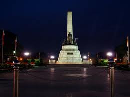
Just beside Intramuros is Rizal Park, a 60-hectare conglomerate of gardens, historical markers, plazas, an artist's sanctuary, a 1913 bronze monument of Jose Rizal, a grand stadium, an observatory, an open-air concert hall, a light-and-sound theatre, restaurants, food kiosks and playgrounds, with dozens of fountains. Fronting the northwest side of the park is Manila Hotel, whose lobby is one of the most imposing in the world. Along the park's bayside, tourists can have an unobstructed view of the fabled Manila Bay sunset.

A five-minute walk from Rizal Park is the National Museum, the official keeper and guardian of the country's cultural, historical and natural heritage. It houses the representative works of the National Artists, as well as the renowned paintings of Felix Resurreccion Hidalgo and Juan Luna. It puts on display some prehistoric finds, including the Tabon skullcap, pottery, ceramics and other artifacts from China and Indochina and remnants of pre-Hispanic boats that brought Malay immigrants to the Philippines dating to about 1250. Other establishments worth visiting in the area are the Metropolitan Theater and the National Library.

Intramuros


Intramuros, the walled city multifaceted built by the Spaniards upon their occupation of Manila, is a marvelous way to spend the day in Manila. It is located along the southern bank of the Pasig River and was built by the Spaniards in the 16th century and is the oldest district of the city of Manila, the capital of the Philippines. The name is taken from the Latin, intra muros, literally "Within the walls", meaning within the wall enclosure of the city/fortress, also describes its structure as it is surrounded by thick, high walls and moats. During the Spanish colonial period, Intramuros was considered Manila itself.

It is constructed almost completely of stone blocks and possesses the same architectural traits one can see in other Spanish defenses like the Caribbean. It has been attractively landscaped with abundant tropical flowers and plants, and it is a relief for many families looking for shade in ever hot and muggy Manila. One can walk around the paths or use the pleasingly decorated horse drawn carriages. Some of the features of this park are old gunpowder rooms used as recently as World War II, seminaries and chapels, the Manila cathedral and museums. It is recommended that if going for the first time, a driver or guide be hired from your hotel. This is a gigantic area neighboring Rizal Park, and it is not recommended to hire an amateur guide loitering near the entrance.

Pagsanjan Falls


A popular tourist destination, Pagsanjan Rapids and Falls is a series of 14 rapids punctuated by mini-waterfalls on the way to the main falls. Pagsanjan is a small Laguna town which served as the setting for Fracis Ford Coppola's film "Apocalypse Now."

The terrain towards the main falls offers a lot of exitement. As one negotiates the waterway, the trips becomes wilder, with the river flanked by towering cliffs lush with vegetation. Waters from the Cavinti and Luisiana dams cascade down Pagsanjan Falls and into a segregated part of the river which is about 150 feet deep. Here, one can rent a raft and enjoy riding under the falls.


Boracay Island


Widely known as one of the finest swimming destinations in the world, Boracay is blessed with unsullied fine talcum powder-sand beaches. Its tranquil crystal clear waters are perfect for swimming, sailing, fishing and sunbathing. Boracay also boasts of sapphire seas and spectacular sunsets. Countless hidden coves dot the island and tall coconut trees line up along the beaches.

Boracay lies at the northwest tip of Panay, in the west Visayas region, off the Sibuyan Sea. The island is made up of little communities: Yapak in the north, Balabag in the middle, and Manocmanoc in the south. Hilly elevations up to 100 meters above sea level characterize Yapak and Manocmanoc. Intertwining trails link the small villages together but many sometimes lead to lush tropical jungles.

To get to Boracay, one has to book a flight to Kalibo, the capital of Aklan province. Air-conditioned coasters or public buses offer one-hour-and-a-half drive to Caticlan where one can board a motorized banca for a 30-minute trip to Boracay.

Subterranean River


The Puerto Princesa Subterranean River National Park features a spectacular limestone karst landscape with its underground river. A distinguishing feature of the river is that it flows directly into the sea, and the lower portion of the river is subject to tidal influences. The area also represents a significant habitat for biodiversity conservation. The site contains a full mountain to the sea ecosystem and protects forests, which are among the most significant in Asia.
The site of the Puerto-Princesa Subterranean River National Park is located in the Saint Paul Mountain Range. It is north-west of Puerto Princesa, the capital of Palawan Province. The topography varies from flat plains to rolling hinterlands and hills to mountain peaks. Over 90% of the park comprises sharp, karst limestone ridges around Mount St Paul, which is itself part of a series of rounded, limestone peaks aligned on a north-south axis, along the western coast of Palawan.
The focus of the area is a spectacular karst landscape which features both surface karst features (pinnacles, shafts, dolines and limestone cliffs), as well as an extensive underground river system. The subterranean river is 8.2 km long, one of the most unique of its type in the world and includes many speleotherms, several large chambers exist, up to 120 m wide and 60 m high. A distinguishing feature of the river is the fact that it emerges directly into the sea, and that the lower portion of the river is brackish and subject to tidal influences.
The underground river (the Cabayugan River) arises approximately 2 km south-west of Mount Saint Paul at an altitude of 100 m, and flows underground for almost its entire length to an outflow into St Paul's Bay. All rivers and associated tributaries are within the park, which is important in relation to catchments impacts on the water quality of the Cabayugan River.

Mount Makiling


One of the inactive volcanoes in the Philippines is Mount Makiling. Also called Mount Maquiling, it is situated in the province of Laguna and rises 1,090 meters above sea level. The forest found in Mt. Makiling is mainly lowland in type, with some montane forest around the peak above 900 m. The forest on most of the lower slopes has been cleared or degraded, but an area of good quality lowland forest remains around the botanic garden and the campus of the University of the Philippines Los Baños (UPLB). There are approximately 2,048 different species of plant.
According to PHIVOLCS (Philippine Institute of Volcanology and Seismology), Mount Makiling is an inactive volcano with no records of eruptions. It is showing no signs of imminent eruption although it has volcanic activity manifested by the boiling mud spring, the numerous hot springs in the area, and the geothermal resource on the mountain’s Batangas side.
The University of the Philippine Los Baños (UPLB) is assigned as the official caretaker of Mt. Makiling. Several types of agriculture can be found in the slopes of the mountain including a coconut plantations inter-cropped with coffees and fruit plantations mixed with pineapples and vegetables. The mountain also performs key ecological functions such as being a watershed and a sanctuary for wildlife.
Aside from the rainforest, Mount Makiling boosts several attractions like Makiling National Scout Reservation which is a campsite at the foot of the mountain, adjacent to UPLB managed by the Boy Scout of the Philippines and is the site used during the 26th Asia-Pacific Regional Jamboree in 2009 and 2010. You can also find the National Arts Center managed by the Cultural Center of the Philippines and the site of the Philippine High School for the Arts (a special school for young artist scholars) and the Pook ni Maria Makiling, an eco-tourism site adjacent to the Jamboree Site. The famous attraction in Mt. Makiling is the mud spring which has a maximum temperature of 80 degrees Celsius. It is the so-called ‘crater’ of the mountain where one could see pools of boiling mud.
Being a protected area, Mount Makiling has become a famous destination for mountaineers, scientists and tourists. There are three trails in climbing the mountain. The first and the frequently used trail is the UPLB route through the UPLB College of Forestry, the second trail is through Makiling Philippine Art’s Center which you can also access via UPLB and the last trail which is the most difficult and unestablished trail is the Sto. Tomas trail located at the other side of the mountain, in Sto. Tomas, Batangas.

The Chocolate Hills


The Chocolate Hills are probably Bohol's most famous tourist attraction. They look like giant mole hills, or as some say, women's breasts, and remind us of the hills in a small child's drawing. Most people who first see pictures of this landscape can hardly believe that these hills are not a man-made artifact. However, this idea is quickly abandoned, as the effort would surely surpass the construction of the pyramids in Egypt. The chocolate hills consist of are no less than 1268 hills (some claim this to be the exact number). They are very uniform in shape and mostly between 30 and 50 meters high. They are covered with grass, which, at the end of the dry season, turns chocolate brown. From this color, the hills derive their name. At other times, the hills are green, and the association may be a bit difficult to make.
Legend has it that the hills came into existence when two giants threw stones and sand at each other in a fight that lasted for days. When they were finally exhausted, they made friends and left the island, but left behind the mess they made. For the more romantically inclined is the tale of Arogo, a young and very strong giant who fell in love with an ordinary mortal girl called Aloya. After she died, the giant Arogo cried bitterly. His tears then turned into hills, as a lasting proof of his grief.
However, up to this day, even geologists have not reached consensus on how they where formed. The most commonly accept theory is that they are the weathered formations of a kind of marine limestone on top of a impermeable layer of clay. If you climb the 214 steps to the top of the observation hill near the complex, you can read this explanation on a bronze plaque.

Taal Volcano


Taal Volcano is located about 60 km SSE of Metro Manila, the capital of the Philippines. It is a complex volcanic system composed of a small volcanic island (Volcano Island), which has been the site of almost all historic activity, located within a 20x30 km lake-filled complex caldera(?) (Taal Lake, in older texts was also called Lake Bonbon), one of the great volcano-tectonic depressions of the world.
Taal as the Decade Volcano for the Philippines Thirty three eruptions have been recorded since 1572 at Taal, mostly on Volcano Island. The impacts of these eruptions were largely confined to the intracaldera area. Occasional violent activity, however, such as the 1754 plinian eruption, affected the entire region, including what is now the Metro Manila area with fallout. Some activity, such as the 1749 eruption, were accompanied by crustal disturbance and strong earthquakes, which generated ground fissures and pronounced subsidence that extended across Taal Lake.

The Hundred Islands


The Hundred Islands National Park in Brgy. Lucap, Alaminos City, Pangasinan is 250 kms. from Manila.

This National Park covers a land area of 1,884 hectares with 123 islands. However, only three (3) islands have been developed for tourists namely: Governor, Quezon, and Children's Island.

Of the three (3) Islands, only the Governor's Island keeps a Guesthouse which is ideal for family use. It has 2 bedrooms, living room, dining room, comfort room/bath and kitchen. Linens, water (4 drums), generator lighting, ceiling fans, dining and cooking utensils/equipments are provided for.

The bahay kubos at Children's Island are for budget travellers as it consists only of screened bedrooms with kerosene lighting and one (1) drum of fresh water and linens. Common areas are provided for dining and cooking as well as for toilet and bath.

Mayon Volcano


Mayon Volcano (Mount Mayon) is an active strato volcano found in Albay Bicol on the island of Luzon, Philippines. It has a perfect cone shape; It was named after a legendary folk Daragang magayon. It was among the 7 wonders of nature in the Philippines. Mayon Volcano reaches 2,460 meters and is the central feature of the Albay Province, of which Legazpi City is the capital, about 300-km southeast of Manila. It must be one of the most beautiful volcanic cones anywhere in the world and is visible for miles around in the otherwise flat landscape of the region. The volcano is still active and has erupted in 2000 and 2001. There is a research station (PHIVOLCS) located about one-third of the way up that is accessible by road and is the jump-off for climbers. Mayon Volcano is the Philippines’ most active volcano and is considered to be the world’s most perfectly formed volcano for its symmetrical cone. It is a basaltic-andesitic volcano. The upper slopes of the volcano are steep averaging 35-40 degrees and are capped by a small summit crater. Its sides are layers of lava and other volcanic material. It is located on the eastern side of Luzon, beside the Philippine Trench which is the convergent boundary where the Philippine Sea Plate is driven under the Philippine Mobile Belt. Where a continental plate or belt of continental fragments meets an oceanic plate, the lighter continental material overrides the oceanic plate, forcing it down into the Earth’s mantle. Magma may be forced through weaknesses in the continental crust caused by the collision of the tectonic plates. One such exit point is Mayon.
RECORDED ERUPTION
Mayon Volcano has a total of forty-nine eruptions. The first recorded major eruption was in 1616. At present the volcano is weakly erupting and may be building up to a larger hazardous eruption. The most destructive eruption of Mayon occurred on February 1, 1814. Lava flowed but not as much compared to the 1766 eruption. Mayon Volcano’s longest uninterrupted eruption occurred on June 23, 1897 which lasted for seven days of raining fire. Lava once again flowed down to civilization. Seven miles eastward, the village of Bacacay was buried 15 m (49 ft) beneath the lava.
  • 2006 Eruption – Mayon erupted from July to October 2006, it has no loss of life recorded.
  • 2008 Eruption – Mayon Erupted last August 10, 2008. A summit explosion ejected ash 200 metres above the summit, with the ash drifting east northeast.
  • 2009-2010 Eruption – It was monitored from July 2009 to January 2010. Until January 13, 2010, it has reduce its hazards of eruption.

Tubbataha Reefs Natural Park


Tubbataha Reefs Natural Park is home to some of the most beautiful coral reefs in the world. Rising from the volcanic depths of the Sulu Sea in the western Philippines, these magnificent atolls encompass an astonishing diversity of marine life.
The park is an underwater sanctuary where nature thrives. Tubbataha is the Philippines' first national marine park and is also a UNESCO World Heritage Site, a place of global importance being preserved for future generations of humankind.
Tubbataha supports an unparalleled variety of marine creatures. Colorful reef fish crowd corals growing in the shallows while sharks and pelagics haunt the steep drop offs to the open sea.
A team of rangers are stationed on the reef year-round and, from March until June, divers visit Tubbataha to experience the wonders of this unique underwater world.

The Banaue Rice Terraces


The Banaue Rice Terraces (Tagalog: Hagdan-hagdang Palayan ng Banawe) are 2000-year old terraces that were carved into the mountains of Ifugao in the Philippines by ancestors of the indigenous people. The Rice Terraces are commonly referred to by Filipinos as the "eight wonder of the Philippines". It is commonly thought that the terraces were built with minimal equipment, largely by hand. The terraces are located approximately 1500 meters (5000 ft) above sea level and cover 10,360 square kilometers (about 4000 square miles) of mountainside. They are fed by an ancient irrigation system from the rainforests above the terraces. It is said that if the steps are put end to end it would encircle half the globe.
Contrary to popular belief, the Banaue Rice Terraces are not part of the Rice terraces of the philippines cordilleras UNESCO inscription but are declared a National Cultural Treasure as the Ifugao Rice Terraces. Ancient sprawling man-made structures from 2,000 to 6,000 years old, other terraces are found in the provinces of Kalinga, Apayao, Benguet, Mountain Province and Ifugao But only those in Batad, Bangaan, Mayoyao, Hungduan and Nagacadan, all in Ifugao, are inscribed as a UNESCO World Heritage Site.
Locals to this day still plant rice and vegetables on the terraces, although more and more younger Ifugaos do not find farming appealing, often opting for the more lucrative hospitality industry generated by the Rice Terraces. The result is the gradual erosion of the characteristic "steps", which need constant reconstruction and care. In 2010 a further problem was drought, with the terraces drying up completely in March of that year.